
Built for teams that need climate data to move at enterprise speed
EarthScan API combines scientific accuracy, automation, and flexibility, giving you full control over how climate intelligence flows into your systems.
Science you can trust
Access the same validated climate modelling that powers the EarthScan platform, CMIP6, CORDEX, ERA5, and Bayesian inference, structured for direct integration.

Automation at any scale
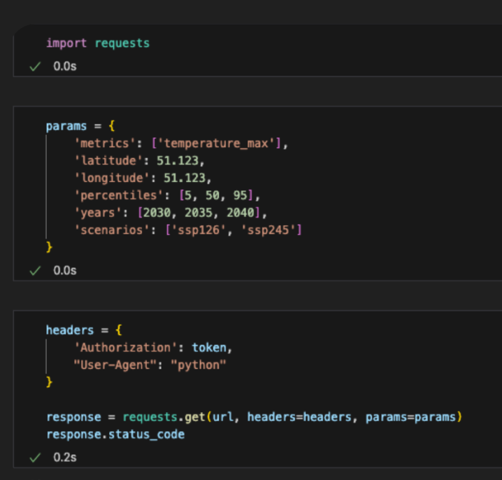
Integrate via scripts or pipelines to run thousands of queries automatically, eliminating manual uploads and repetitive tasks.

Full control, down to the query
Request exactly what you need: hazards, scenarios, return periods, and percentiles. Get standardized, science-backed outputs ready for analytics, stress testing, or regulatory reporting.
Enterprise-ready delivery
Delivered in JSON or CSV formats, with usage-based pricing, full developer documentation, and sandbox access, making it simple to embed climate data directly into your existing stack.

Aligned with the world’s leading climate and reporting standards


Access climate risk intelligence in three simple steps
No dashboards. No bottlenecks. Just climate intelligence on your terms.
1
Define your query
Select hazard type, time horizon, scenario, and return period.

2
Send your API call
Retrieve hazard metrics, risk ratings, or financial indicators for any coordinate, asset, or scenario.

3
Integrate and scale
Feed the results into your own systems, from internal dashboards and underwriting engines to regulatory disclosure workflows.

Direct access to our climate science
Built on the same validated modelling engine as EarthScan, the API combines CMIP6, CORDEX, and Bayesian inference to deliver asset-level hazard, exposure, and financial risk data you can trust, ready to feed directly into valuation models, underwriting engines, or ESG dashboards.
Granular control over every query
Retrieve exactly the data you need, by hazard, scenario, time horizon, percentile, or return period, and automate regulatory and stress-testing workflows (CSRD, IFRS S2, or TCFD), with parameters that align to your internal models.
Custom financial metrics (CvAR and thresholds)
Estimate potential losses for flood and wind using built-in CvAR or define your own thresholds based on asset characteristics like floors, materials, or occupancy, integrating physical climate data directly into financial risk, insurance pricing, and investment models.
Automation and scale
Each call retrieves one signal, but the API integrates seamlessly with scripts, pipelines, or ETLs, enabling portfolio-wide analysis or multi-client delivery with zero manual effort.
Seamless integration into your stack
Receive clean, structured JSON or CSV outputs that connect instantly with databases, GIS tools, dashboards, or risk systems, embedding climate intelligence into the tools your teams already use.
Developer-ready and enterprise-secure
Includes sandbox access, production environments, detailed documentation, and enterprise-grade SLAs, allowing teams to prototype integrations quickly and deploy confidently across production systems or client platforms.
Flexible pricing and fast deployment
Start small and scale on demand with usage-based pricing that fits your workload. Deploy pilots or proof-of-concepts quickly, then expand to portfolio-wide automation as needs grow.
Proven performance across industries
Already powering insurers, investors, and consultancies worldwide to automate physical climate risk analysis, fuel internal dashboards, and generate audit-ready metrics for regulatory reporting.
Trusted by innovators integrating climate data at scale
Chief Risk Officer at Sustain 2050
Managing Director
Head of Catastrophe Modelling
Award-winning climate intelligence
Frequently asked questions
Quantitative hazard metrics (temperature extremes, precipitation, drought days, flood depth), qualitative A–F ratings, financial indicators like CvAR, and exceedance probabilities – all across multiple climate scenarios and timeframes.
IPCC-aligned SSP 1-2.6, SSP 2-4.5, and SSP 5-8.5 scenarios, with return periods from 2 to 1,000 years and optional 5th–95th percentiles.
Yes, our Custom CvAR endpoint lets you input asset attributes (floors, materials, occupancy) for tailored flood and wind loss estimates.
Each call returns one location / signal, but integrations through scripts or pipelines allow automation across thousands of assets, ideal for enterprise portfolios.
All responses are returned in JSON, structured for immediate integration into analytics, dashboards, or risk systems.
Pricing is usage-based, which means that you pay only for what you query, with volume discounts for high-frequency users.
Yes. You’ll get complete API documentation, code examples, and sandbox credentials for testing before production deployment.
Absolutely. Many clients use the EarthScan UI for exploration and visualisation and the API for automation and scale, both share the same scientific foundation.

Take full control of how climate data powers your business
Automate climate risk quantification, feed hazard and financial data into your own tools, and scale climate intelligence across your portfolio.
